Tuesday, June 26, 2018

Off to Twillingate

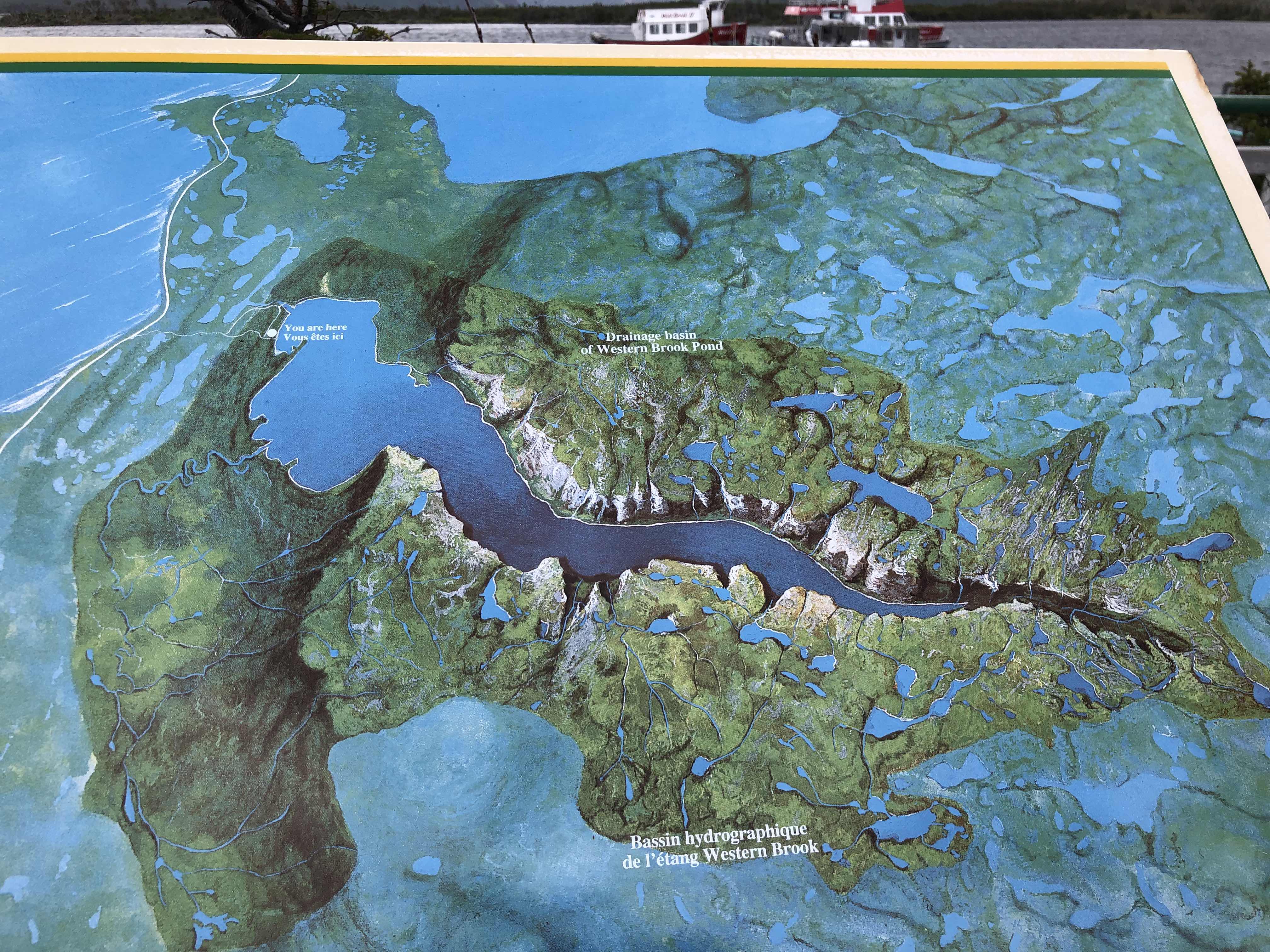
Yesterday was a driving day.  We left Gros Morne around 8:30 am and headed east.  The temperature was getting colder and the winds were picking up a bit, but we made it to Twillingate late yesterday afternoon.

What a beautiful spot.  After we had dinner together, we went out for a walk onto this little island we could see from our RV park called “Batrix Island”.


Looking at Back Harbour of Northern Twillingate Island from on top of Batrix Island.  Yeah, we had our hoods up, and winter coats on.  Thank goodness we brought them!
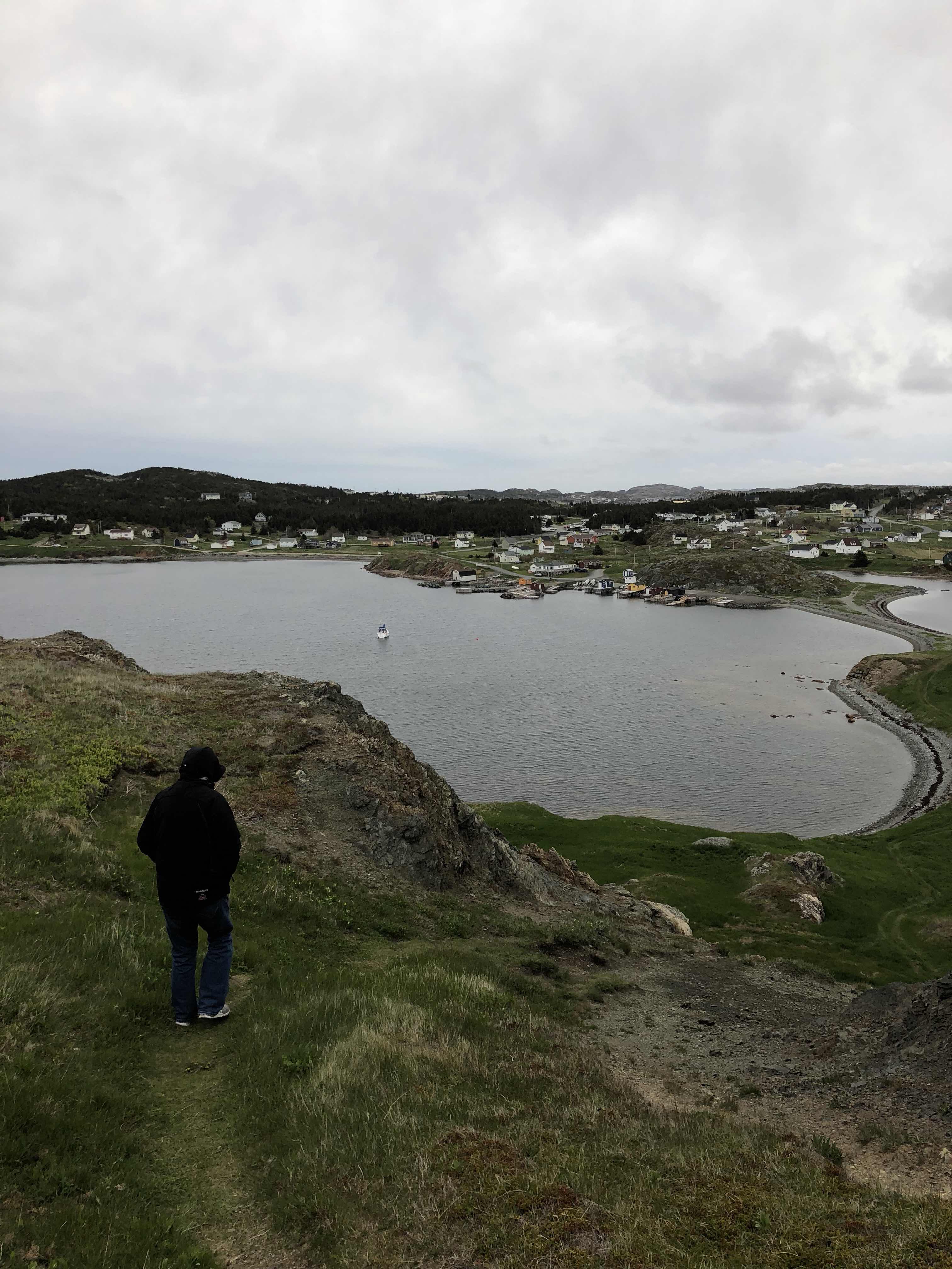
Such a pretty spot.

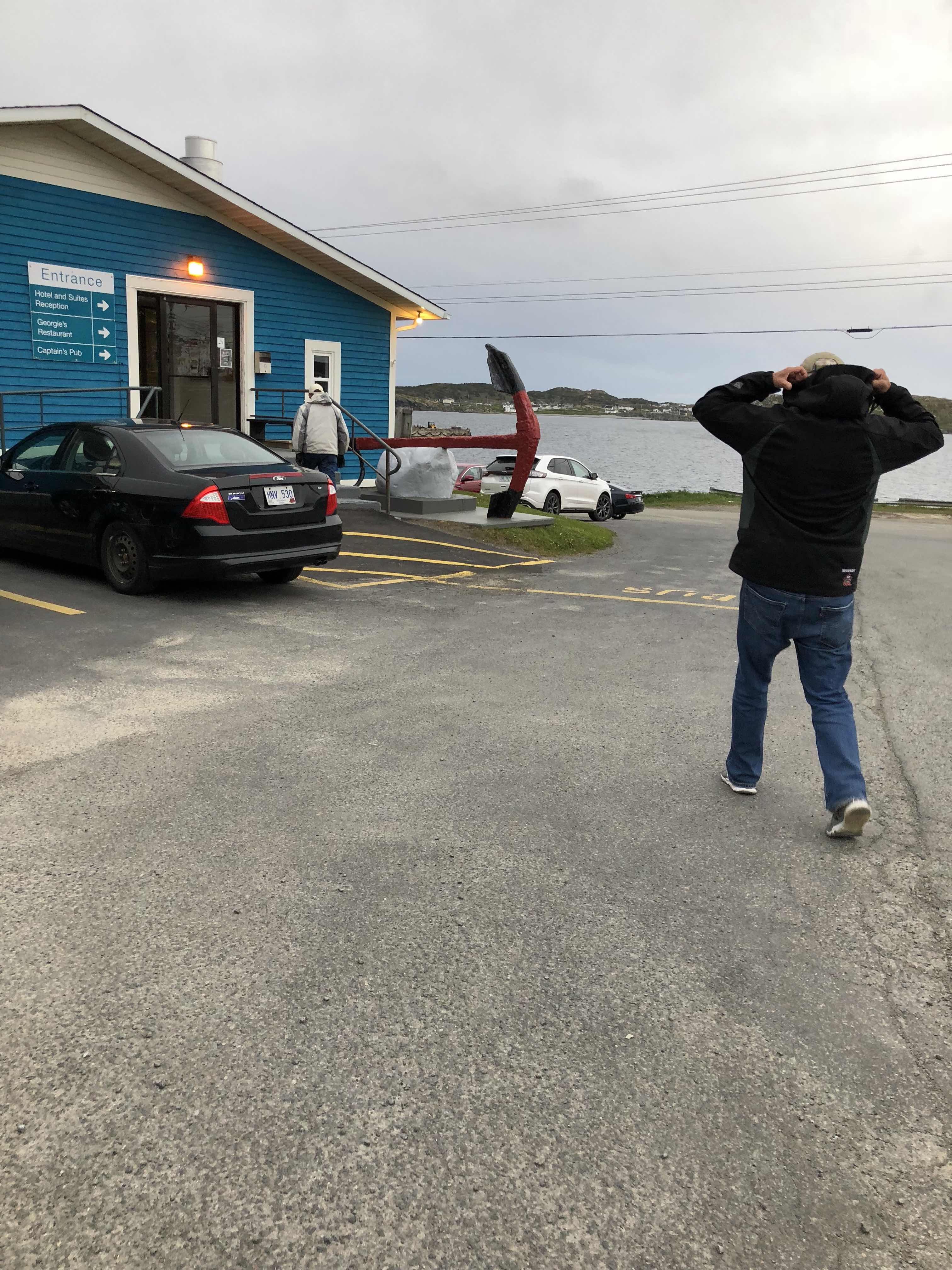
On the way back, we thought we would just blow by our RV park and we continued along the road to head to a local bar where a guy was playing.  This gives you some perspective.  The tulips are blooming!  Spring is here!


You’d never know it though.  Here we are walking into the Anchor Motel, Captain’s Pub.

Love the board inside the pub.

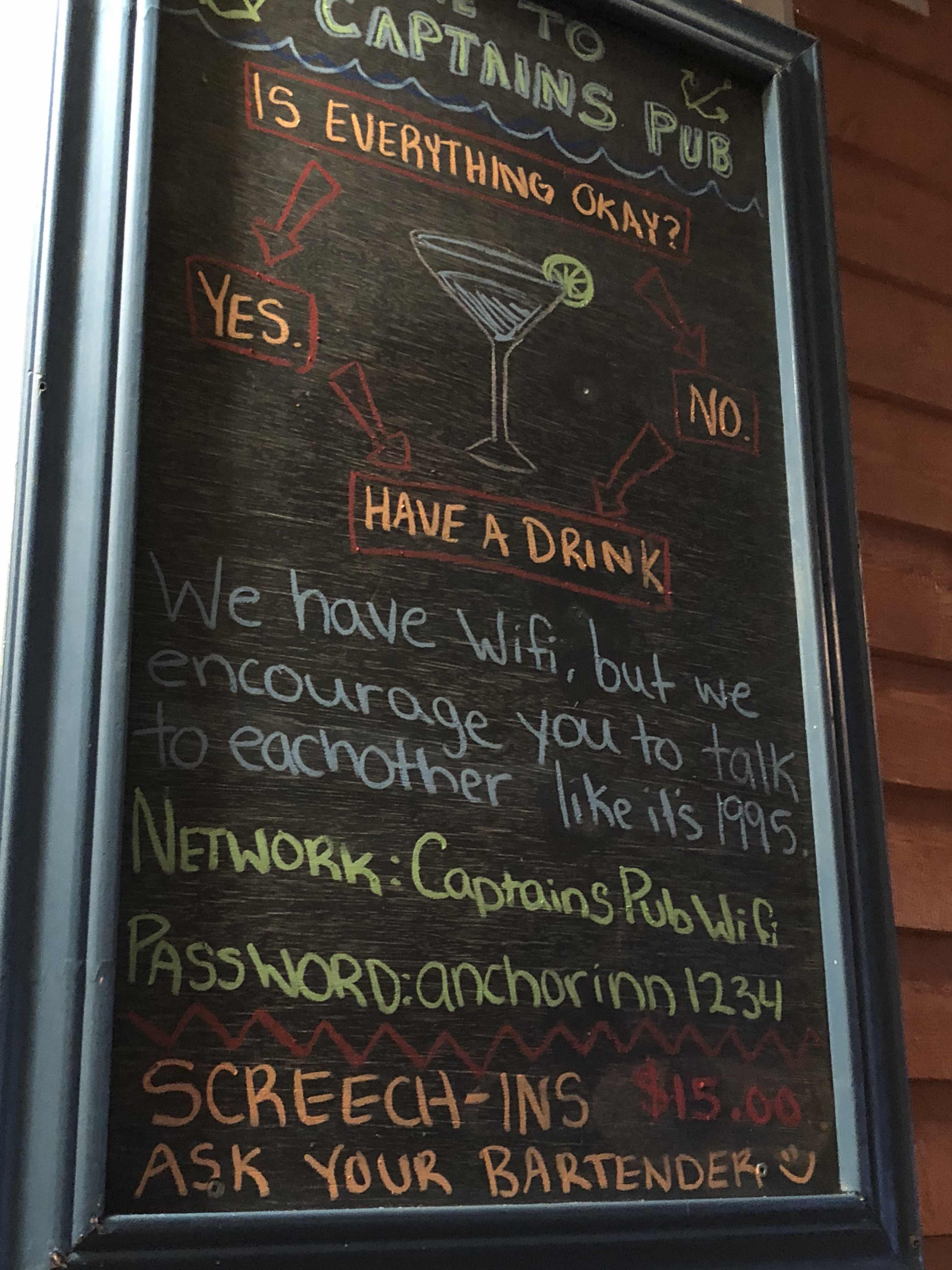
We still haven’t done a “screech-in”.  We’re waiting for the right moment.  That’s essentially a ceremony where they acknowledge you as a new Newfie.
This morning was a miserable, rainy day.  2C when we got up — 2!!!  And very wet and windy.  We spent a leisurely morning, then we all decided to take a drive to see what was what around the island.  Even if we didn’t get out of the vehicle much.

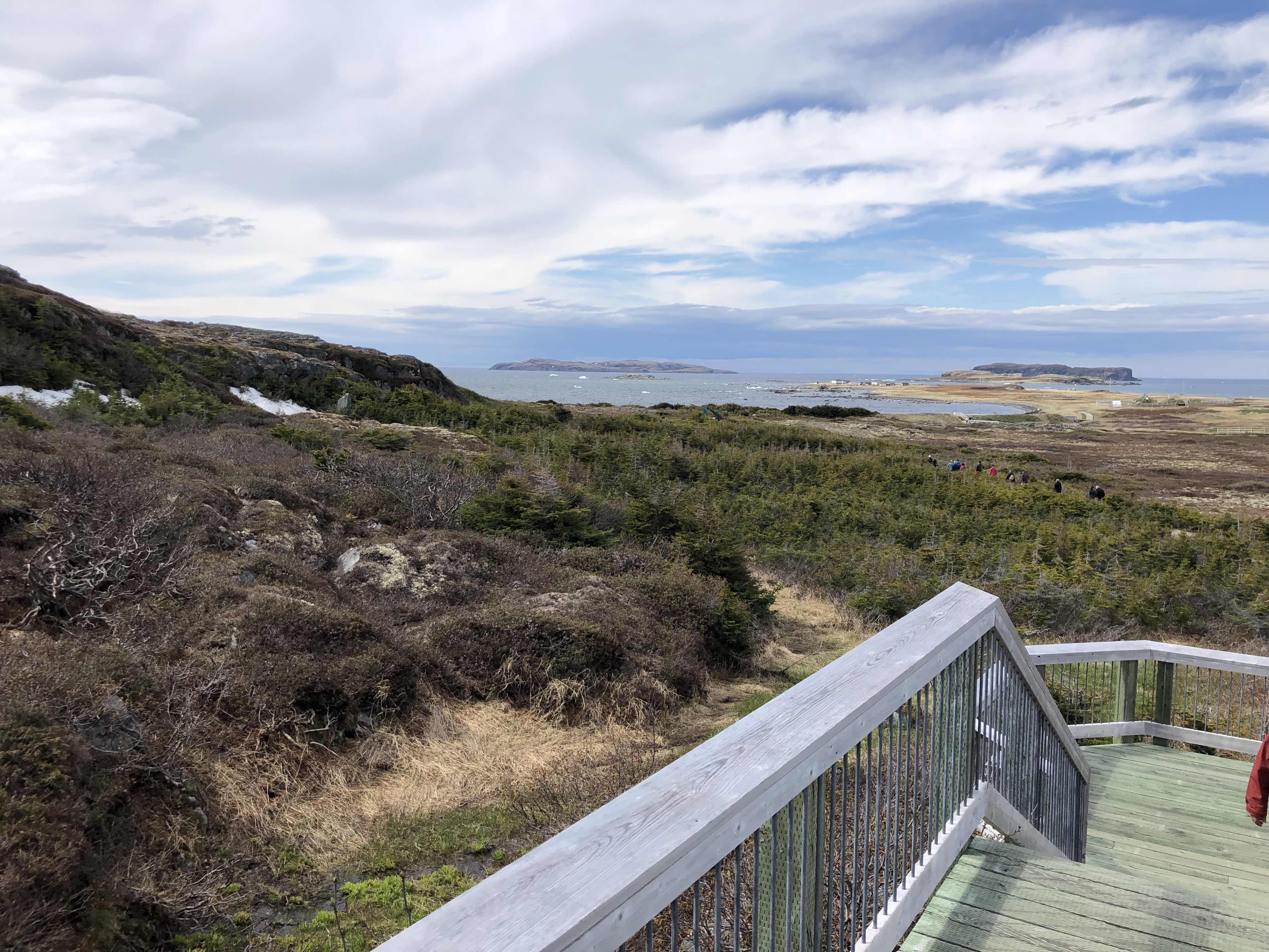
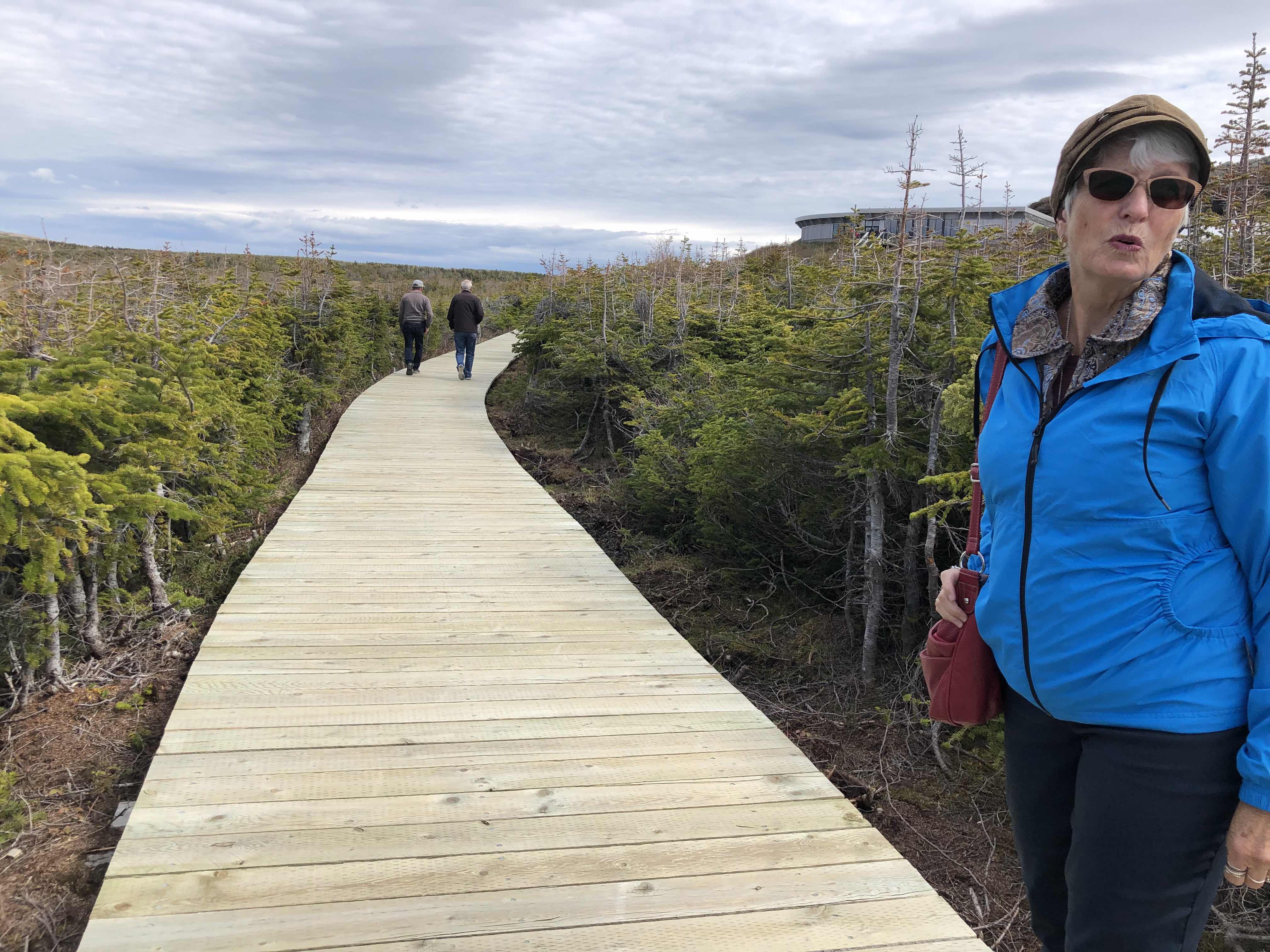
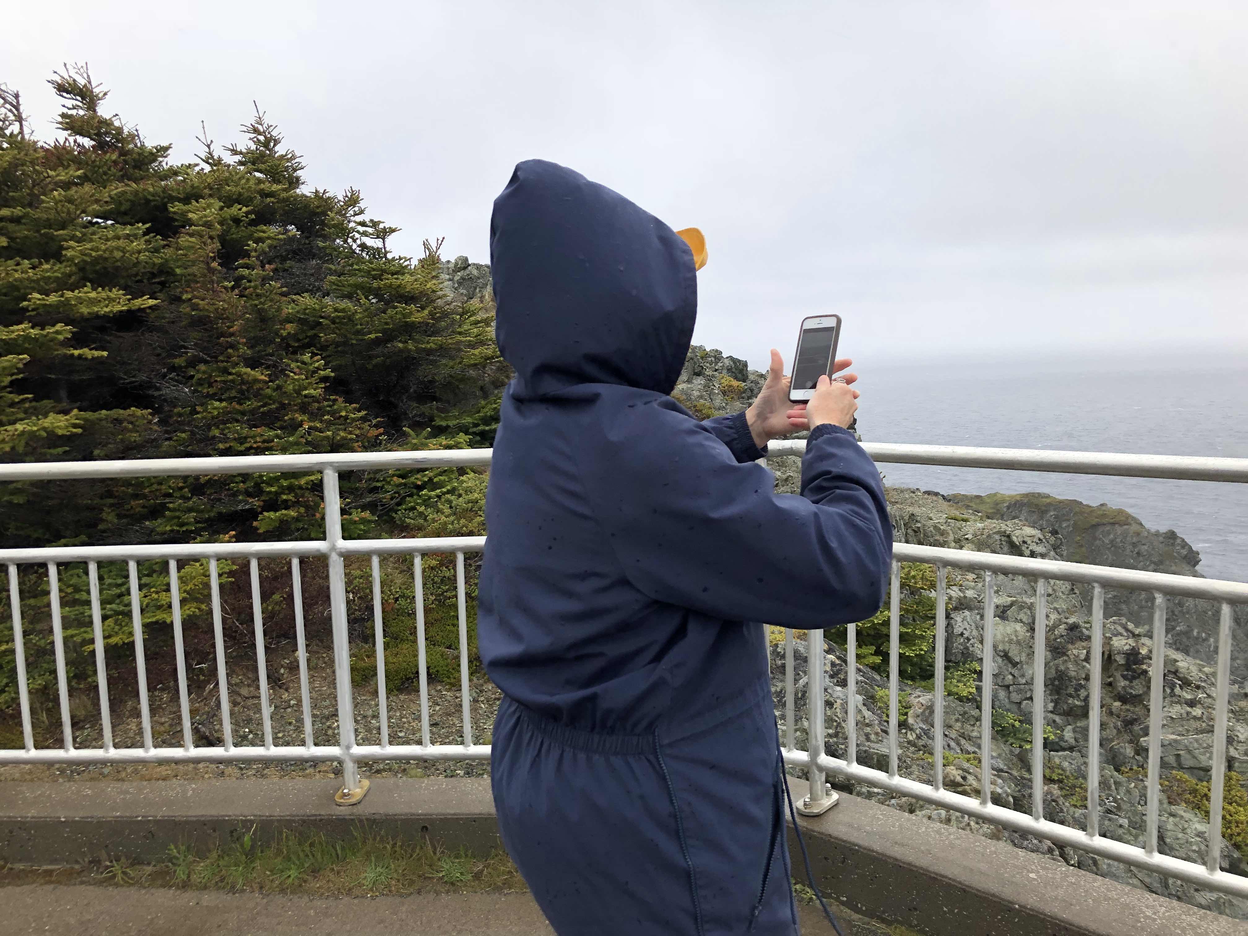
We first drove up to the lighthouse, which we really want to come back to visit on a nicer day.  Tons of hiking trails around here, and beautiful scenery.  Judy trying to get a picture of snowflakes in the air.  Yes, SNOWFLAKES!  It’s Junuary!


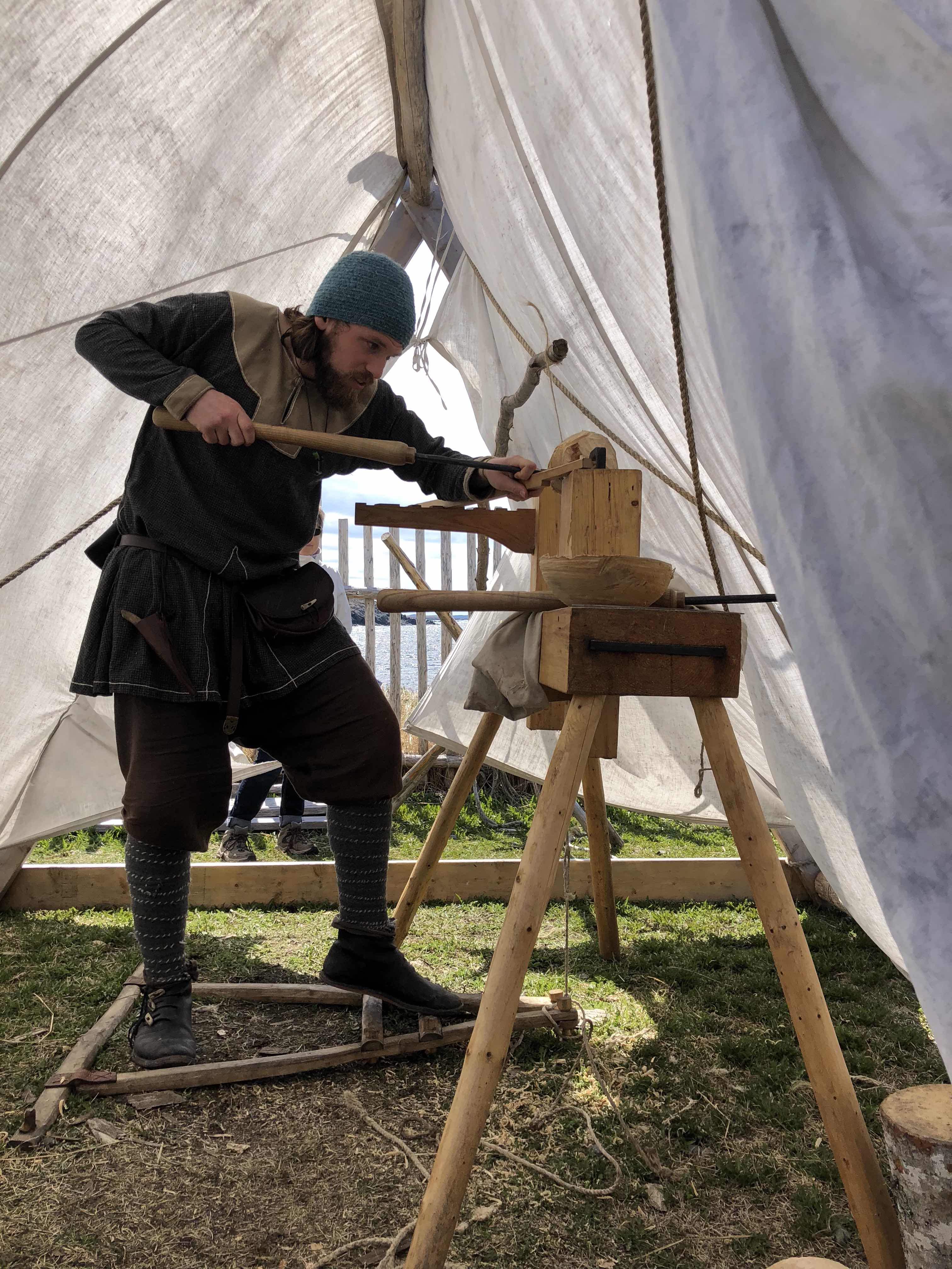
We stopped at the Durrell Museum.  Just some local history and artifacts.  Good way to spend half an hour on this miserable day.  This guy was in the museum.


Love some names around here.

Could have blown down today, alright.

But the views are still gorgeous.  Just a sampling.

This guy got blown over.

Tonight we’re heading to the Twillingate Dinner Theatre.  Supposed to be better weather tomorrow.  Can’t wait.


Easy Day of Hiking

Today (Sunday) was a day to just relax for a while and catch up on a few things.  When the work was done, I went for a bit of a hike around the pond on the RV property.  Nice trail.  This is looking across the pond back to our RV park.


A nice little creek running down the stone.  The rock is all shale, and lying in pieces everywhere.


After lunch we decided to do the Green Point coastal trail.  They have discovered these layers of rock along the coast that hold a world geological benchmark between 2 periods of time not located anywhere else (I think I have that right).  This is up close.    Tectonic action has turned the layers of rock on its side.


And this is from up top.


This was taken from on top of the cliff.  Hard to see the depth from up top, but this goes on out to sea for a bit.  We could see the waves rolling as it hit the ledge.


Here we are relaxing and enjoying the view.


As we strolled along the coast, we came to this bog area covered in trees that are now dead from the weather and wind, I suppose.  Elves could walk through here quite easily.  This went on as far as we could see.


Someone had built a lovely inukshuk.


And this is looking back at where we were before.  The point out to the left is Green Point with the geological rock layers.  The chairs we were sitting on are out there on top.


We ended our day as quietly as it started.  Taking a break from the activity.  We would have a fairly long day of driving on Monday.


Sunday, June 24, 2018

Back to Gros Morne


On Friday we made our way back from the far north to Gros Morne National Park, truly a beautiful park on the west side of Newfoundland.

It was an uneventful drive, and on the way back, we stopped at Arches Provincial Park between Portland Creek and Parson’s Pond.  Beautiful.


All this wave action stuff that formed the arches.  Some have fallen.  But some are still standing.

The trees along the coast are a little scraggly.  The wind is brutal at times.


After we were all set up for our stay, we wandered into Norris Point.  At the Kat Stop Cafe, they had this guy playing and singing.  What a beautiful evening to be on a patio.  Had to wear a jacket, but it was still nice.  This is the view from there.


And this is the guy singing.  Angus is his name, I think.  And we saw him the next night too...but I’ll get into that later.  He does a great job and we enjoyed every minute of listening to him sing both Newfie tunes and other folk-type songs.


Saturday, we decided to do the Westernbrook Pond boat tour.  Such a beautiful part of Gros Moren.  It was carved from the glaciers and is now an inland fjord.  This is a photo board of the “pond”.  From the “You are here” point to the end, it is about 16 km.


I took so many photos of the whole thing, I couldn’t possibly publish them here.,  But here’s our boat (the one on the right), and looking at the area to where we were going.


This is one of many waterfalls we saw.  Absolutely gorgeous.


And this is the iconic look at the end of the fjord.


The crew, especially this guy, made it an absolute blast.  We were all playing the spoons or the tambourine (made with beer caps) and toe-tapping to Newfie jigs and reels.  It was a real hoot.


We thoroughly enjoyed the day on the “pond”.

In the evening, we went into Rocky Harbour for dinner and a show.  The show featured a Kitchen Party at the local pub.


Gerard and I enjoyed our Quidi Vidi beer.


We all got into the act in one form or another.  Here’s Judy singing with the hired singer.  An awesome job, I might add.


And here are John and Gerard up dancing the Newfie Stomp.  (You wouldn’t know it, but trust me.)


A good time was had by all.  They like their parties.

The end of a great day.  Another day to come here in Gros Morne.


Saturday, June 23, 2018

Icebergs

On Thursday, we drove over to St. Anthony, which was only about 40 minutes away as we had decided to do a boat tour for icebergs and whales.  We booked the tour, then went for a drive out to the lighthouse at Fisher’s Point.


There’s also a cafe there where we had some lunch as well.  And...we got to see this from the lighthouse road!  A fair size iceberg, which we learned had broken in half a couple of days ago.  So it was much bigger.  And when a chunk breaks off, more of the underside is exposed as it rolls.


While we were in the cafe, this bird was sitting on Gerard’s shoulder, watching him eat.


So this was our boat.


And here we all are, heading out for the cruise.


There were other “berger bits” and “growlers” all over the place, not to mention pack ice which flowed into the harbour in droves, catching the current down from Labrador.

But this was the granddaddy we saw, about 5-6 miles away from the harbour.


They estimated it was about 70 feet high.  I was a little concerned being too close to it.  Some had broken off just that morning, and it had turned.  The smooth parts are where it was under water.  The blue lines are where water was running through the ice while it was still part of the glacier.


These come from west Greenland and get caught in the Labrador current.  The area is aptly named “iceberg alley”.

It was an impressive berg, we must say.

Back in the harbour, I thought this looked rather hilarious.  Is he digging for cod?


Unfortunately, no whales were to be seen.  It’s a tad early, and the spring/summer is so late, they’re not quite here yet.  There have been a few, but not many.  Humpbacks are what they normally see at this time of year.

However, what they did see in this town in the morning was a polar bear!  They said the bears migrate south while the seals migrate south on ice floes.  And this bear is probably heading back north again.  They walk a long way, and swim a long way as well.  They would swim across the strait to get back to Labrador and other parts north.  You wouldn’t want to get in its way.

Heading back south on Friday.


L’Anse aux Meadows

On Wednesday, we drove up the western coast of Newfoundland all the way to the top.  We drove through oodles of little fishing villages as the Gulf of Saint Lawrence narrows to the Strait of Belle Isle and you can see Labrador across the strait.


When we arrived around 2 pm, we quickly set up our RVs then headed over to L’Anse aux Meadows National Historic Site and were able to catch up with a guided tour that had just left the building.


Hey guys...check out that beautiful land o’er thar.


This was our guide who walked us through the sites of the archeological dig.  He was there when that was happening.  He said he used to play, as a kid, in the holes, etc., left by the Vikings.  They all used to think it was just native Indian relics.  There was some of that, but little did they know it was the Vikings who had built the houses of sod.  You can see the shape of one in this photo.


They have reproduced the “buildings” in another section of the same materials.

When we were done with the archeological finds, we went into the reproduction area where they have people in costume interpreting what would have happened.  This guy is making a bowl out of a hand-made lathe.

This guy was in the living/kitchen areas, and in fact, people would have slept here too.  They are all quite informative.

This symbolized the stand-off the Vikings had with the native Indians.  There were 4 attempts by the Vikings to settle here, and every time they were fended off by the natives.  After the 4th attempt, they just gave up.  They were outnumbered by a long shot and didn’t stand a chance.

The other thing this sculpture represents is the "circle of humanity".  Humans started in Africa, they moved north to Europe and spread out east and west from there.  The eastward migration resulted in the native Indians ending up in North America.  The westward migration resulted in the Vikings ending up in North America, thereby completing the circle!


This is a shot of the replication village as it stands today.  Such a barren land here.

A view of the area from the steps of the building leading down to the sites.

Complete with boardwalk.

And yeah - there’s snow here.

That was our day when we landed in this northern tip of Newfoundland.